
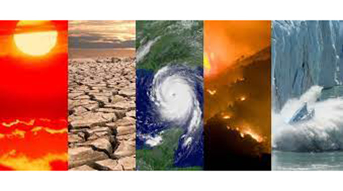
Zimbabwe: Extreme weather events intensify
Sifelani Tsiko-Agric, Environment & Innovations Editor
From record devastating droughts to ruinous floods, veld-fires and the early end of the rainy season, the frequency of extreme weather conditions is increasing in its intensity in Zimbabwe, showing a pattern that is becoming familiar across Africa and other parts of the world.
Human-induced climate change is intensifying these devastating extremes and this is now showing in Zimbabwe.
In a report reviewing Zimbabwe’s 2020-21 rainfall season at the on-going 25th Southern African Regional Climate Outlook Forum (SARCOF-25), Benjamin Kwenda, an agricultural meteorologist at Meteorological Services Department said the onslaught of extremes seen in the previous cropping seasons, showed a marked increase and were in line with global predictions.
“Extreme weather events are becoming more intense and occurring at an increased frequency in recent seasons,” he said in a report reviewing Zimbabwe’s rainfall performance in the 2020-2021 rainfall season.
“Their occurrence was evenly distributed across the country. The maximum 24-hour rainfall amounts ranged between 70mm and 90mm across much of the country.”
In the report, Kwenda said the highest 24-hour total was 140mm at Chisengu in Manicaland followed by 123mm (Gokwe) and 120mm (Kanyemba).
“There were pockets of areas, which received between 50mm and 70mm in 24 hours. The country experienced copious rains during the 2020/21 rainfall season mainly due to an active ITCZ and cyclones,” he said.
“It can be recalled that during the 2019/20 season, Chisengu recorded 179,5mm in 24 hours whilst during Cyclone Idai in the 2018/2019 rainfall season Chisengu recorded 407,5mm in 24 hours.”
A stretch from Kadoma through Mvuma, Chivhu to Chisengu and Chipinge in the Eastern Highlands had a higher frequency of extreme events.
The highest was seven at both Mvuma and Bikita, followed by six at Kadoma, Buhera, Chivhu, Chisengu and Filabusi.
However, they were less in parts of Masvingo Province and along the Zambezi Valley, which experienced less than two.
Climate change was now one of the biggest challenges facing Zimbabwe and most other countries in Africa.
It is leaving many communities vulnerable to the impacts of extreme weather events because of their limited ability to cope and adapt to those events.
Limited resources in terms of access to technology, skill development and economic capacity contribute to low levels of possible adaptation — still remain a huge challenge.
The State of the Climate in Africa 2019 report, a multi-agency publication coordinated by the World Meteorological Organisation (WMO) shows increasing climate change threats for human health, food and water security and socio-economic development in Africa.
This is marked by increasing temperatures and sea levels, changing precipitation patterns and more extreme weather patterns that is threatening human health and safety, food and water security and socio-economic development on the continent.
The early on-set and off-set of the rains is another sign of the climate extremes Zimbabwe is now facing.
Kwenda said the time series for the 2020 season showed that the season started in November and that was later than the 2019 season.
“In the 2020/21 season, the peak was in January. The same happened in 2018 season although the rainfall amount was far lower than the mean and that of the 2020 season. In the 2019 rainfall season, the peak was in February,” he said.
“It is interesting to note the way the rainfall amount dropped from January, it was following almost the same curve of the 2019 season. The decrease in mean rainfall between January to March was very sharp as compared to the reference period of 1981 to 2010.”
In Zimbabwe, the rainfall season starts in October and gradually increases to a peak in January every season.
The highest rainfall is normally received in January and the rainfall starts decreasing from February through March, when the season ends.
“The 2020/21 rainfall season was heralded by isolated rainfall activity that commenced in October. Significant improvement in the rainfall was observed in December where it was well above the mean,” Kwenda said in the report.
“In January, the rainfall amount was well above the climatological mean. It started easing off in February but ended abruptly in March. In fact, in the period December-January-February, the country received very good rains.”
Effective rainfall ended as early as 25 February for much of the country while in the central areas stretching from Binga going south-eastwards to Masvingo, the rains extended beyond the climatological end of season dates.
In the Eastern Highlands, Rusape-Nyanga-Mukandi area still had effective rains up to 21 March.
However, there were pockets of places, where the rains ended before the climatological end of season dates.
These include Lusulu in Matabeleland North and Kanyemba in Mashonaland Central.
“The forecast was a hit in Region 1, a half-hit in Region 3 and a miss in Region 2.
“There were some patches where the forecast was spot-on while in some areas the direction of the forecast was in the opposite direction,” Kwenda said in the report analysing the score of seasonal forecast for the 2020-2021 season.
“For Regions 1 and 2, the forecast was a hit while for Region 3 it was a half-hit. Much of Region 3 was in the above normal category.”
The agricultural meteorologist said the 2020-2021 rainfall season performed well and it was consistent with both the 2020-21 SARCOF and National Climate Outlook Forum issued in August and September 2020 respectively.
“The whole country ended the season in the normal to above normal category,” Kwenda said.
Zimbabwe’s national rainfall season was characterised by an early onset of rains and an early cessation of rains across the country from 25 February 2021.
“Extended dry spells were hardly experienced, instead, long wet spells ensued.
“Temporal and spatial distribution of rainfall was good especially in the months of December, January and February,” Kwenda said.
“The longest wet spell duration went up to 80 days. Several storms of 50+ mm in 24-hours were in December, January and February.”
Last year, regional experts scored a major hit when the consensus forecast produced by the 24th Southern African Regional Climate Outlook Forum (SARCOF 24) correctly predicted that the bulk of southern Africa would receive adequate rainfall throughout the 2020-2021 growing season.
This brought good cheer to the region which experienced less rainfall in the 2019-2020 season resulting in adverse impacts on agriculture, water resources and hydro power generation in most of the region.
The 2020-2021 outlook produced by regional climate experts forecasted that there would be “normal to-above-normal” rainfall across most of the SADC region between October 2020 and March 2021.
Zimbabwe and most other countries in the region got a good harvest during the 2020/21 agricultural season with the exception of parts in Angola and Madagascar.
However, all key climate indicators and associated impact information from regional and global bodies all point to relentless, continuing climate change, an increasing occurrence and intensification of extreme events, and severe losses and damage, affecting people, societies and economies.
“The negative trend in climate will continue for the coming decades independent of our success in mitigation. It is therefore important to invest in adaptation. One of the most powerful ways to adapt is to invest in early warning services and weather observing networks.
“Several less developed countries have major gaps in their observing systems and are lacking state of the art weather, climate and water services,” said Prof Petteri Taalas, World Meteorology Organisation secretary — general in a report made in 2019.


You Might Also Like
-
FOOTBALL remains the country’s flagship sport, but has sadly continued to be anything like the top sporting discipline with mostly those involved with the game either as administrators, coaches, players and fans conspiring to make a mockery of its status. The Castle Lager Premier Soccer League is only eight Match Days into the 2024 season, […]


Agriculture Journal

Comments