

Honeymoon over for illegal water users

Elita Chikwati Senior Agriculture Reporter
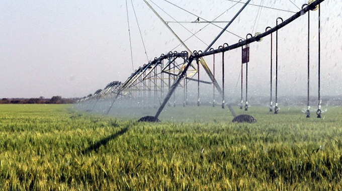
The Zimbabwe National Water Authority (ZINWA) will, starting this winter cropping season, be using the Geographical Information System (GIS) to monitor raw water abstractions along river channels and irrigation activities at farms to curb illegal water abstractions and ensuring that holders of agreements comply with the conditions contained in their contracts.
The new development will also help protect legitimate users of water whose allocations are partly drawn by illegal users before they reach their abstraction points.
Zinwa corporate communications and marketing manager Mrs Marjorie Munyonga said the GIS will also allow ZINWA to detect instances where farmers may have understated their hectarage when they signed water abstraction agreements.
“Through the new system; every three days, ZINWA downloads satellite images that show irrigation activities and the actual hectarage being irrigated, which allowing the authority to note any inconsistencies between what is on the ground and what is on the agreements.
“The satellite images also show ZINWA where there is irrigation activity but without water abstraction agreements, which will then prompt the Authority to investigate the source of water for the irrigators,” she said.
Mrs Munyonga said in terms of Statutory Instrument 206 of 2001, all individuals and entities intending to use or using raw water from ZINWA owned and managed dams for purposes other than primary purposes were required to enter into water abstraction agreements with ZINWA.
“These agreements allow ZINWA to make reservations of water allocations for users in the dams and only releasing water from the dams in line with the requirements of the agreement holders and environmental provisions.
“ZINWA has already gathered the co-ordinates for the farms with agreements which will make it possible to monitor using the new system,” she said.

You Might Also Like
-
Precious Manomano Herald Correspondent Access to water is improving at Chikurubi Maximum Prison following the commissioning of a borehole at the Canine School (Dog Section) by The Salvation Army Chief Secretary, Colonel Tineyi Mambo. Salvation Army Men’s Ministries provided funds for the borehole. Colonel Mambo thanked the Men’s Ministries for the good work. “I would […]


Agriculture Journal

Comments