AfriGEOSS symposium ends on high note
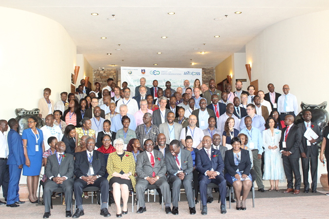
Delegates who attended the 1st AfriGEOSS Symposium in Victoria Falls recently
Sydney Kawadza : Senior Features Writer
Three days of probing and debating through the first-ever AfriGEOSS Symposium, an air of triumph swept through the auditorium at Elephant Hills in Victoria Falls. Zimbabwe had once again successfully hosted an international event. Delegates had gone through diligent and productive sessions on how Africa could make the most of the Geo-Information and Earth Observation.The two make part of the Global Earth Observation activities.
The symposium was organised on behalf of the Zimbabwean Government by the University of Zimbabwe and the Research Council of Zimbabwe.
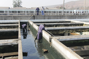
It also came at a time when Zimbabwe and the Southern African region are suffering from the effects of a serious El Nino-induced drought.
The solution to the research scientist attending the symposium was satellite information for preparing and monitoring such weather.
The Global Earth Observation System of Systems deals with critical areas that are critical to sustainability of life including agriculture, biodiversity, natural disasters, water, weather and climate, health and energy.
Policy Coordination and Promotion of Socio-Economic Ventures Minister in the President’s Office Simon Khaya Moyo acknowledged Government firmly believes that Earth Observation provides were an essential platform for collective observing the earth for the common good of humanity.
“Given developments in Earth Observation and Geo-Information Science aligned technologies, we are convinced that GEOSS will meet the need for timely, quality long term global information as a basis for sound high level decision making,” he said.
Minister Khaya Moyo said the Zim-Asset policy document was founded on scientific evidence based decision making Earth Observation activities its core.
University of Zimbabwe department of Geography and Environmental Science Studies chairman Professor Amon Murwira concluded at the end of the symposium that Geo-Information and Zimbabwe were becoming a leading player in Africa on technology development.
“First of all, we need to highlight the importance of the space and Geo-Information Science and Earth Observation in contributing to economic development of the continent and Zimbabwe in particular including food security which feed into our Zim-Asset policy document through the Food and Nutrition Cluster,” he said.
The systems, Prof Murwira said, also benefited in environment management and disaster resiliency mechanisms among others.
The AfriGeoss is part of the Global on Earth Observation community which was formed following the resolution of the 2002 United Nations World Summit on Sustainable Development and the G8 summit of 2003.
It aims at improving policy decisions by coordinating strategies among participating voluntary governments and international organisations.
The group also facilitates the acquisition and dissemination of land, air, sea and space data towards building a coordinated and sustained information system, the Global Earth Observation System of Systems (GEOSS).
Its focus on information sharing and capacity building in Earth Observation presents opportunities for local experts to develop as well as to access important data generated from the GEOSS.
Africa has its own chapter of GEOSS, AfriGEOSS, which has the same mission as the GEOSS but with particular focus on Africa.
Professor Murwira pointed out the importance of capacity building in Africa.
“Zimbabwe is leading in this aspect, especially at the University of Zimbabwe, where all students are taught to be business-oriented and innovative,” he said.
“We are becoming a significant player as shown with the successful hosting of the first ever symposium in Africa. That was Team Zimbabwe at play and it’s a lesson that should galvanize our efforts to enhance the systems.”
In recognising that Geo-information Science and Earth Observation has a critical human resources skills shortage in Zimbabwe and abroad, the University of Zimbabwe is working on curriculum review on the topics.
“The University of Zimbabwe is also introducing a degree in Aeronautic Engineering to complement our commitment to capacity building. We are also improving a data warehousing capability which is at 60 terabytes,” Professor Murwira said.
He said the number of Geo-information Science and Earth Observation students from 24 in 2012 to over 2016.
“We intend to grow our Geo-information Science and Earth Observation Cluster to 1000 graduates by 2019.”
The 1st AfriGEOSS Symposium Summary Report Outcomes, Actions and Recommendations, to meet the AfriGEOSS objectives, and enable its progressive implementation.
It was agreed that they should be work on the establishment National GEO Coordination Mechanisms, strengthening the AfriGeoss Governance structures and bringing it into political discussion to inform and influence policy formulation.
The symposium also agreed to promote and ensure the use of Earth Observation and Information in decision-making while confirming the mandate of the Data and Infrastructure Coordination Team and consolidating its work plans.
The Victoria Falls symposium also undertook to the establishment of thematic coordination mechanisms within AfriGEOSS.
In establishing national GEO coordinating mechanisms, the AfriGEOSS, member states are strongly encouraged to establish national GEO mechanisms that will leverage on existing local EO investments, mobilising additional funding for local and regional EO initiatives and projects, strengthening regional coordination and active participation in AfriGEOSS among others.
Strengthening the AfriGEOSS Governance Structure will look at enabling and facilitating members’ commitment, to improve the information flow, and to establish close linkages with the national, regional and global structures.
AfriGEOSS member states will work together to define and set up the appropriate governance structures that will improve information flows from the GEO Executive Committee, Programme Board, AfriGEOSS Steering Committee to Coordination Teams, Working Groups and the broader EO community.
By bringing AfriGEOSS into political discussions to inform and influence policy formulation, connections and linkages of EO activities with national, regional and global policy and strategic frameworks are critical for the success of AfriGEOSS through continued engagement with regional and continental ministerial structures such as SADC, AMCOMET and AU and extend engagement to other regional structures.
This also seeks enabling and supporting the implementation of the African Space Policy and Strategy and ensuring alignment with and response to UN SDGs, including addressing SDGs goals, targets and indicators.
Promoting and ensuring the use of EO Data and Information in decision-making looks at developing a dedicated AfriGEOSS Communication and Outreach Plan to continue to demonstrate the relevance and importance of EO by showcasing applications, information products and services that respond to societal challenges, particularly in the proposed priority areas, namely, forest management, food security, urban planning and water resource management whilst also contributing to the SDGs and other SBAs.
Thematic coordination mechanisms within AfriGEOSS include the AfriGAM which would develop a concept for the implementation of a continental level initiative on Food Security and Agriculture (AfriGAM), based on coordination and harmonisation of the on-going projects/initiatives and addressing the national and continental needs as well as the contributions to global processes/commitments.
The Sustainable Forest Management looks at developing a community of practice for forest management in Africa, bringing together all the existing initiatives in Africa and strengthen linkages with global initiatives.
The African Earth Observation community is continuously growing and is establishing its presence in the region and in the global arena, taking also benefit from the national and regional programs and from the on-going cooperation initiatives with a great number of external Partners.
The AfriGEOSS initiative, developed within the GEO framework, seeks to strengthen the link between the current GEO activities with existing capabilities and initiatives in Africa and will provide the necessary framework for countries and organisations to access and leverage on-going bilateral and multilateral EO-based initiatives across Africa, thereby creating synergies and minimising duplication for the benefit of the entire continent.
This coordination initiative has been recognised essential to enhance Africa’s capacity for producing, managing and using Earth observations, thus also enabling the Region’s participation in, and contribution to, the Global Earth Observation System of Systems.
AfriGEOSS aims to provide the necessary framework for African countries and organisations as well as international partners to access and leverage on-going local and international bilateral and multilateral EO-based initiatives across Africa, thereby creating synergies and minimising duplication for the benefit of the continent.
It’s rare to capture unorthodox presentations but delegates to the symposium but South African government official from the Department of Science and Technology Humbulani Mudau told a joke of two Russian scientists who dug a hole in the ground and when they got to 1 000 feet they found copper wires dating back 1 000 years old, so they concluded that their forefathers had telephones in those days.
He said: “American scientists went and dug a hole of 2 000 feet and found optic fibres dating back 3 000 years ago, so they concluded that their forefathers had high speed communication in those days.
“African scientists said okay and dug a hole of 5 000 feet and found nothing, so they concluded that their forefathers had wireless in those days.”
His reasoning: Africa has always been way ahead in technology hence the need to benefit from the latest available.
You Might Also Like
-
ADDRESSING the nation yesterday from Murambinda B High School, the centre of the national celebrations of the 44th anniversary of Independence, President Mnangagwa, while acknowledging the severe drought this year, was upbeat and positive about Zimbabwe and how it is coping. The drought, the most severe for 40 years and basically the worst in the […]


Agriculture Journal

Comments